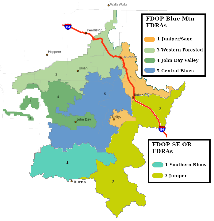
A fire danger rating area (FDRA) is defined as: A geographic area relatively homogenous in climate, fuels and topography, tens of thousands of acres in size, within which the fire danger can be assumed to be uniform. Its size and shape is primarily based on influences of fire danger, not political boundaries. It is the basic on-the-ground unit for which unique fire management decisions are made based on fire danger ratings. Weather is represented by one or more NFDRS weather stations. (NWCG Fire Danger Working Team. 2002. Gaining an Understanding of the National Fire Danger Rating System. NWCG, PMS 932, Boise, Idaho. 72 pp.)
A comprehensive analysis of the Blue Mountain area was conducted using Geographic Information Systems (GIS) programs and data. All of the data sources utilized were developed consistently across the entire area, not unique by ownership.
The primary data utilized includes Digital Elevation Model (DEM), EPA Level IV Ecoregions, Oregon and Washington GAP Vegetation, and climate data produced by Oregon Climate Services and distributed by The Climate Source (CSI). Climate data included average monthly (for the period 1960-1991): Maximum Temperature, Average Temperature, Minimum Temperature, Relative Humidity, and Precipitation.